It is exactly four months ago today that Russian troops invaded the territory of Ukraine. The war in this country is still ongoing, with no end in sight. Groundstation has been reporting on the use Read More

It is exactly four months ago today that Russian troops invaded the territory of Ukraine. The war in this country is still ongoing, with no end in sight. Groundstation has been reporting on the use Read More

For the 12th time, the Copernicus Masters 2022 is opening its submissions to award innovative solutions that use Copernicus Earth observation (EO) and other space data. The competition partners, with global players from institutions, research and Read More
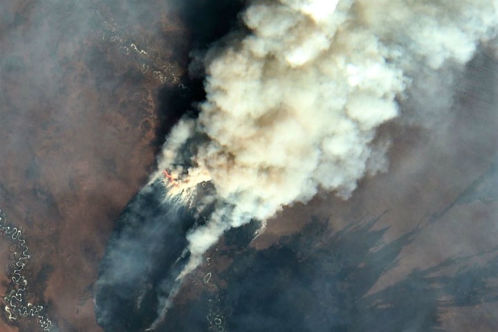
Spring and summer are the peak seasons for wildfires. Its consequences can be devastating, ranging from significant loss of forest areas and risks to residential areas, to animal deaths and severe air pollution. One of Read More

This is the third issue of our monthly digest. As usual, we make an overview of the news and insights we shared with you this month. #StandWithUkraine At Groundstation.space, we continue to share Read More

The Groundstation European Essay Competition provides a platform for young, ambitious students to exercise their writing skills and participate in the European Space Community At groundstation.SPACE we are striving to build a vibrant community Read More

From the first days of the invasion of Russian troops into the territory of Ukraine, we have written about the possibilities of using satellite data technologies to support the people of Ukraine. This week marks Read More

The interpretation of Synthetic Aperture Radar (SAR) satellite images involves the identification and measurement of targets in a radar image. This radar image is the result of extensive data processing, including calibration, geometric, and radiometric Read More
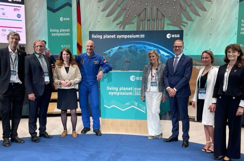
Attracting thousands of scientists and data users, the ESA Living Planet Symposium LPS22 is amongst the biggest Earth observation conferences in the world. For decades now, Earth observation has played a fundamental role in advancing Read More

Before the invasion of Russian troops into Ukraine, the city of Mariupol was a steel and machine-building centre stretching along the Sea of Azov, at the mouth of the Kalmius and Kalchik rivers. Today, Mariupol Read More
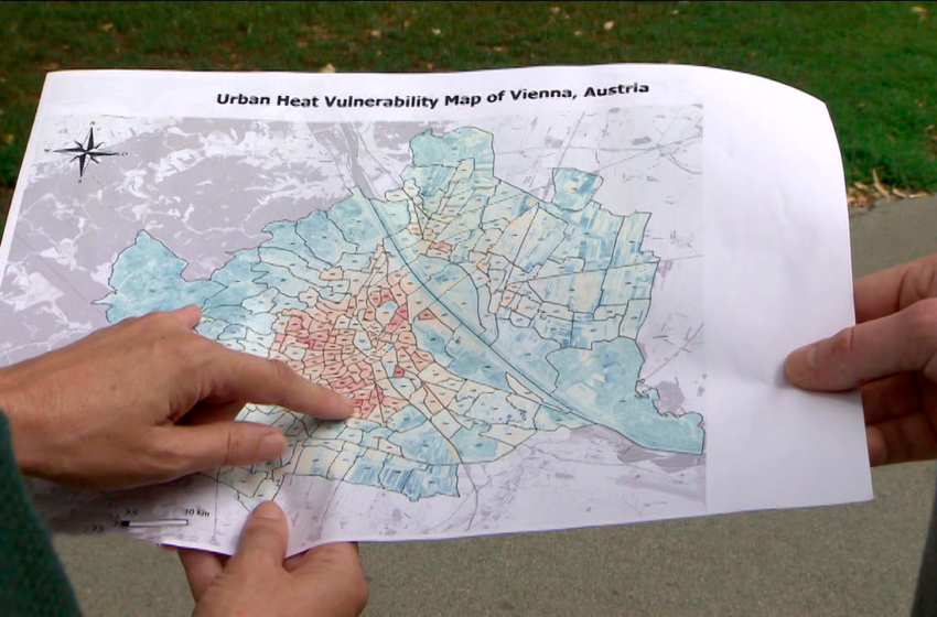
Cities experience higher temperatures than their rural surroundings. These higher temperatures can negatively impact human health, including causing cardiovascular and respiratory disorders, as well as heat stroke. It is therefore crucial to lower heat stress Read More

© 2023, dotSPACE Foundation - All rights reserved.