From Pixels to Preservation: How Remote Sensing Advances Biodiversity Research
- Earth
Gabriela Quintana Sánchez
- 0
- 14 minutes read

Featured Image Credit: Freepik
Digital Twins and Biodiversity
Nowadays, many scientific groups work with techniques and methods to preserve biodiversity and contribute to making sustainable environmental decisions. DotSPACE, with Nature FIRST (look at Nature FIRST)[1][2][3], is developing preventive capabilities for nature conservation by combining ecology sciences and environmental forensics with environmental observations (satellite-based and on-site). The project includes existing initiatives and projects to help develop an integrated European biodiversity monitoring system, notably EUROPABON (look at EuropaBON – Europa Biodiversity Observation Network: integrating data streams to support policy), the Knowledge Centre for Biodiversity, the BiodivERsA Partnership (look at The European Biodiversity Partnership | Biodiversa-plus | Project | Fact sheet | HORIZON | CORDIS | European Commission (europa.eu)) and the consortia for related projects in Horizon Europe.
The Nature FIRST project proposes a (digital twin) model-driven, continuous form of ecosystem monitoring, assessing the numbers of species and states and the modelled ecological and anthropogenic processes within an ecosystem and their interactions. We will then be able to find cause-effect relations and improve our monitoring models based on retrofits and simulations to understand changes even better. The models, also called Digital Twins, are thus a means for learning and creating context to translate environmental observations (data) into facts and actionable information (intelligence) for site managers and policymakers.
From Pixels to Preservation: How Remote Sensing Advances Biodiversity Research
When we talk about diversity, we refer to the variety of living species on Earth- including plants, animals, bacteria, and fungi. Nonetheless, many species are threatened with extinction due to human activities, putting these ecosystems at risk. Many scientists are interested in studying biodiversity on a global scale; to study how many species exist in single ecosystems, such as a forest, grassland, tundra, or lake. Each ecosystem hosts a wide variety of species that all play a role relative to each other.
Some areas have more biodiversity than others; these are called hotspots. All of Earth’s species work together to survive and maintain their ecosystems. For example, the grass in pastures feeds cattle. Cattle then produce manure that returns nutrients to the soil, which helps to grow more grass. This manure can also be used to fertilise cropland. Many species provide essential benefits to humans, including food, clothing, and medicine.
Biodiversity and Remote Sensing
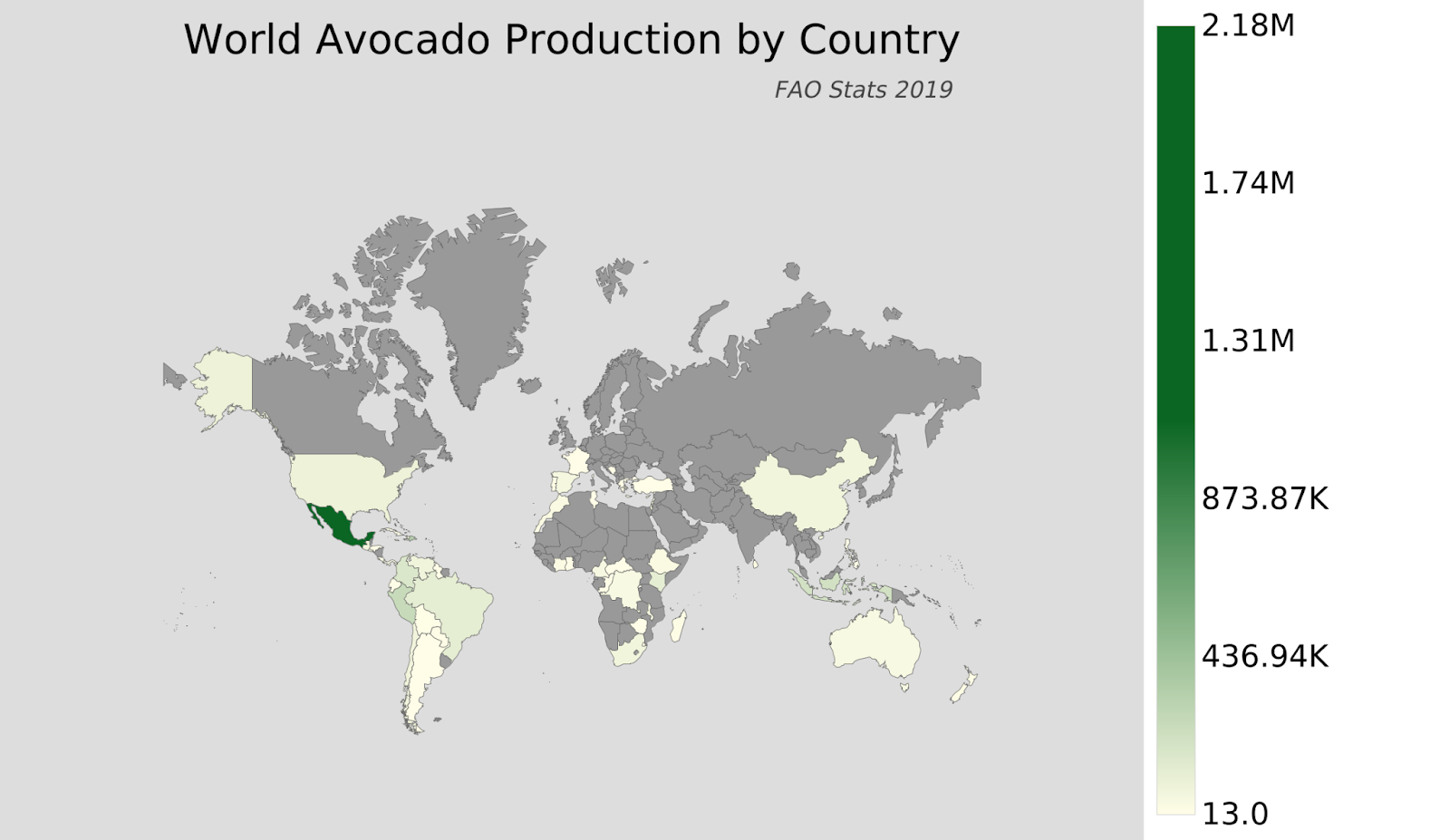
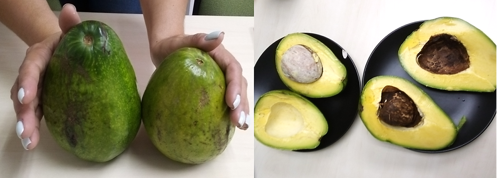
The Persea Americana of the family Lauraceae is an evergreen tree whose fruit is the avocado, mostly belonging to subtropical or tropical family ecosystems. It is rich in potassium and vitamins B, E, and K and is also used in cosmetics, soap, and oil production. Nonetheless, the demand for avocados in the EU threatens the extinction of ecosystems in tropical and subtropical regions worldwide, not by the fruit crop itself but by the rampant commercial activity surrounding it. The largest avocado producers globally include Mexico, the Dominican Republic, Peru, Colombia, the United States, Chile, and Brazil in America. While Spain, France, Greece, Cyprus, Switzerland and Portugal are the main producers in the EU.
In various articles published on the web, avocado cultivation requires a high use of pesticides and other agrochemicals that have polluted the soils and waters and has also led to the depletion of water sources in regions previously rich in water resources.
Nonetheless, avocado production sustainability depends on the amount of water that is needed. Despite being a tropical crop, according to an FAO and University of Twente report, it requires an average of 1,000 l/kg, less than citrus fruits or bananas. Other crops, such as almonds or cocoa, need 4,000 and 7,000 litres, respectively. Also, the Institute for Tropical and Mediterranean Horticulture “La Mayora”, belonging to the University of Málaga, informs that there are avocado varieties tolerant to salinity and water stress. He adds that, in Málaga and Granada, most growers have reduced the amount of water to 700 litres/kg. Besides that, there is an ongoing project to reduce that figure to 500 litres (Spain: Avocado, the most fashionable fruit in Europe | Nieuwsbericht | Agroberichten Buitenland).
The appropriate selection of crop area is vital for its sustainability, the satellite images are one of the tools adequate for that selection.
Nowadays, it is common for buyers to ask for assurances of good practices; this is due to concerns about excessive water use in monoculture avocado cultivation in arid production areas, in addition to social issues and deforestation. The best way to do this is through adopting social and environmental standards. Major avocado buyers have ecological and ethical policies in place.
Using effective management techniques in natural resources is critical for selecting, monitoring, and sustainable food resources. The Food and Agriculture Organization (FAO) emphasises the importance of ensuring the compatibility of natural resources with the utilisation of existing areas and societal needs. Land-use planning is an efficient tool for systematically assessing the potential of land to select and adopt the best-use options.
The remote sensing platforms present an accurate alternative to the manual fruit count method and for the non-invasive measure of avocado yield. Whilst these technologies are highly effective for measuring yield in row crops, there has only been limited remote sensing research investigating fruit size and yield mapping, as well as tree number auditing for avocados.
Two case studies
We chose two examples, Robson et al. (2017) [4], show how satellite imagery is used to monitor avocado cultivation in Bundaberg, Australia. In this specific case study, where for each selected avocados orchard block, a Normalised Difference Vegetation Index (NDVI) was applied to quantify vegetation greenness to understand vegetation density and to assess changes in plant health, also followed by an unsupervised classification, to differentiate the variation in tree vigour (health and size) and as such guide where on-ground sampling should be conducted to quantify the variability in terms of the measured yield parameters. In the subsequent figures, we can see trees from high, medium, and low NDVI regions in 2014, 2016 and 2017.

The results from this study indicate the potential of imagery for accurately mapping fruit yield and average fruit size across multiple avocado orchards and seasons in the Bundaberg region of Queensland-Australia. This has important implications, as having accurate pre-harvest yield estimates is vital for planning and forward selling.
The mapping of total fruit weight and average fruit size offers significant benefit to growers for harvest segregation at the start of the season when prices for large fruit are optimal, to target orchard zones with larger fruit better, thus saving on labour costs and time currently used for the selective harvesting of every tree.
On the other hand, Moreno-Ortega et al. (2019) [5], conducted a study of 30-year-old commercial avocado orchards during six consecutive growing seasons (2012–2018). The orchard (9.5 ha) is located in Málaga, south-eastern Spain; it determined the water allowance for irrigating avocado orchards in this region is about 5300 m3 ha in a season, but it can reach about 7000 m3 ha in mature avocado groves of the Andalusian coast. These amounts are far from those of other productive regions (8000-9000 m3 ha in Chile) with higher productivity (i.e. 10.5 t ha for Mexico or 12 t ha for Peru, versus 8.8 t ha for Spain). This is the main reason why growers claim that water allowance is insufficient to fulfil avocado water requirements for achieving good productivity and for keeping the competitiveness of the Andalusian subtropical sector. However, fruit yield is not linearly related to water supply, and contrasting effects of different water supplies on yield and fruit size have been reported in several studies on avocado ‘Hass’.
Now, farmers’ choice of crops for planting varies spatially and among farmers across the different agroecological systems. Hence, their accurate characterisation is paramount for policy-making and implementation strategies for addressing food and nutrition insecurity through precision agriculture.
The lack of knowledge can generate misunderstandings about a crop in particular. It is necessary to study the avocados grow to foment sustainability in those and thus can enjoy without guilt eating guacamole.
Effective planning, careful site selection for planting, adherence to sustainable practices, and continuous quality monitoring are crucial elements that can enable responsible avocado cultivation without causing harm to the environment. While avocado trees themselves do not pose a threat to the environment, it is human activities and improper practices that can lead to negative impacts.
Article edited by Andrei Bocin-Dumitriu
References
[1] NATURE FIRST. WE HAVE A DATA-DRIVEN PREVENTIVE STRATEGY. 2023; About — Nature FIRST
[2] NATURE FIRST. NATURE FIRST: INTRO AND DEMO OF SOLUTIONS FOR BIODIVERSITY MONITORING. 2023; RESOURCES — Nature FIRST
[3] NATURE FIRST. THE NATURE FIRST PODCAST. 2023; THE NATURE FIRST PODCAST — Nature FIRST
[4] Robson A, Rahman MM, Muir J. Using Worldview Satellite Imagery to Map Yield in Avocado (Persea Americana): A Case Study in Bundaberg, Australia. Remote Sensing. 2017; 9(12):1223. https://doi.org/10.3390/rs9121223
[5] Moreno-Ortega G, Pliego C, Sarmiento D, Barceló A, Martínez-Ferri E. Yield and fruit quality of avocado trees under different regimes of water supply in the subtropical coast of Spain. 2019; https://doi.org/10.1016/j.agwat.2019.05.001
Supplementary material: read more about the Nature FIRST project
Interested in knowing more about how environmental forensics can contribute to preserving biodiversity? Please read the project fact sheet below or visit groundstation.space website to learn more about Nature FIRST and other dotSPACE projects.


