EU Funding 4 Copernicus Water Applications
- Funding Marine Water-ForCE
Kacia Rutkoŭskaja
- 0
- 9 minutes read

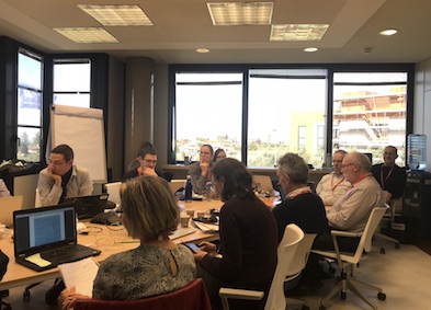
On the first day of summer, the Water-ForCE project held a webinar on EU Funding 4 Copernicus Water Applications. At this event, participants learned was introduced to current funding sources for Copernicus water applications, as well as success stories.
ESA HYDROCOASTAL Project
The topic “Improving SAR Altimeter processing over the coastal zone and inland waters – the ESA HYDROCOASTAL project” was presented by David Cotton, a Senior Consultant and director of Satellite Oceanographic Consultants (SatOC) in the UK. David Cotton develops and promotes practical applications of satellite oceanography data.
HYDROCOASTAL is a project funded under the ESA Science for Society Programme Element. This project aims to maximise the exploitation of SAR and SARin altimeter measurements in the coastal zone and inland waters, by evaluating and implementing new approaches to process SAR and SARin data from CryoSat-2, and SAR altimeter data from Sentinel-3A and Sentinel-3B. HYDROCOASTAL has 14 project partners such as universities, research organisations, etc.
The lineup of the project is following:
- Scientific Review and Requirements Consolidation (completed):
- Review the current state of the art in SAR and SARin altimeter data processing as applied to the coastal zone and to inland waters.
- Implementation and Validation (July 2020 – May 2022)
- Implement new SAR, SARin altimeter processing algorithms to generate 2-year test data set.
- Evaluate the performance of the candidate algorithms.
- Selected algorithms used to generate “global” coastal zone and inland water final products
- Impact Assessment (June – December 2022)
- The impact of global products was assessed through a series of case studies
- Outreach and Road Map (April 2023)
- Recommendations for further R&D and implementation in current and future SAR altimeter missions
After the speaker’s report, participants from different parts of the world asked questions about the project. You can learn more about the ESA HYDROCOASTAL project on the website, and contact its members if you have a question or idea.
Copernicus for Biodiversity and Danube Delta’s Ecosystems
A senior researcher in river morphology in the department of Informational System and Geomatics of DDNI, Cristian Trifanov presented on the topic “Copernicus data role in carrying out research for maintaining biodiversity and to protect Danube Delta’s ecosystems”.
During his presentation, Cristian Trifanov made an overview of the “Danube Delta” National Institute for Research and Development (DDNI)

The main objective of DDNI is to conduct fundamental and applied research for scientific support of the management of the Danube Delta Biosphere Reserve (DDBR) and other wetland areas of national and international interest, with a particular focus on biodiversity conservation and sustainable use.
At the European level, DDNI participates as a partner in the consortia of projects financed under the EC Framework Programmes as well as in projects financed through other programmes and funds.
Presentations from the webinar will be placed on a Water-ForCE website

Fill out the Water-ForCE survey
The Water-ForCE consortium is defining the future of inland water services for Copernicus. We are a scientific partnership, collecting the needs of the public and private sectors of the core Copernicus Programme. We would love to know your thoughts about this!
We kindly invite you to answer a few simple questions in a short survey. This should only take about 2-3 minutes of your time but will provide us with valuable information for our project.
Share Your Experience
Get involved in Water-ForCE and dotSpace activities! / Image credit: Freepik
Groundstation.space invites industry speakers who would like to share their expertise, the results of their work, or their experience with an audience of like-minded people.
Have your say: Opportunities for you to get involved on the Groundstation platform
About Water-ForCE
All six Copernicus Services (Atmosphere, Marine, Land, Climate Change, Security, Energy) deliver water and hydrology related services. However, the European Commission noticed that this way it is hard to get a comprehensive understanding of the global water cycle, there are gaps in water-related products, there is duplication and it is hard for user communities to find relevant Copernicus products. Therefore, the Horizon2020 Space Programme opened a call for a Coordination and Support Action project: “Copernicus evolution: Mission exploitation concept for WATER” to find the best long-term mission concept.
Check out the Water-ForCE project website here
Featured image credit: Freepik


