Vietnam and Space Data: Natural Resource Management through Remote Sensing
Vietnam, known for its breathtaking landscapes and abundant natural resources, has been leveraging space technology to monitor and manage these valuable assets. In recent years, the nation has made significant strides in utilising remote sensing data for Earth observation, leading to more efficient and sustainable resource management practices.
A Glimpse into Vietnam’s Space Exploration
Although the Vietnam National Space Center was established in 2011 (then the National Satellite Center), the country’s space ties go back a bit further. One milestone that captured the world’s attention occurred on July 23, 1980, when Phạm Tuân became the first Asian astronaut to venture into space. As a proud moment for Vietnam, Tuân’s historic mission aboard the Soyuz 37 spacecraft showcased the country’s capabilities and ambitions in the space domain.
Harnessing Earth Observation and Remote Sensing
Vietnam has recognised the immense potential of Earth observation and remote sensing technologies in managing its vast natural resources. One crucial application of remote sensing in Vietnam lies in monitoring and managing natural resources. From lush forests to fertile farmlands and thriving marine ecosystems, remote sensing data offers valuable insights into the health and status of these resources, enabling informed decision-making for sustainable development. Such a contribution can be seen in the Ministry of Natural Resources and Environment’s (MONRE) nationwide land inventory program done every five years.
Since the late 1990s, the Vietnamese government has mandated the utilisation of satellite imagery (First through the Remote Sensing Center and later through the National Remote Sensing Department of MONRE) to produce value-added products for relevant government agencies.
Forestry Management and Agricultural Applications
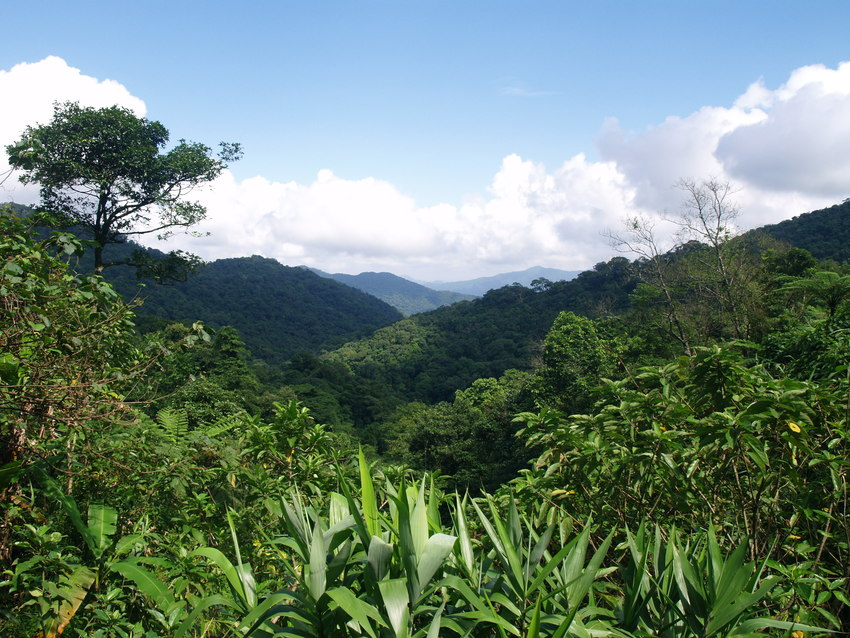
Vietnam’s dense and diverse forests are essential for biodiversity conservation, climate regulation, and the livelihoods of many local communities. However, these forests face numerous threats- including deforestation and illegal logging. Remote sensing technology plays a vital role in monitoring forest cover, detecting deforestation activities, and assessing the impact of these activities on the ecosystem.
The Ministry of Agriculture and Rural Development’s (MARD) efforts to manage, map, plan, and monitor their forests have contributed to large datasets that can be extremely useful in assessing trends around forest resources. By analyzing satellite imagery and remote sensing data, Vietnamese authorities can identify at-risk areas and implement timely measures to protect forests, combat illegal logging, and promote reforestation efforts. This proactive approach ensures the long-term preservation of Vietnam’s valuable forest resources.
Agriculture is a cornerstone of Vietnam’s economy, providing livelihoods for millions of people. Remote sensing technology helps to optimize agricultural practices and enhance productivity. By monitoring vegetation indices (such as rice and other crop monitoring), soil moisture levels, and land surface temperature, authorities can assess crop health and determine irrigation requirements. Farmers and policymakers gain valuable insights into land-use patterns by integrating remote sensing data with Geographic Information Systems (GIS), enabling them to make informed decisions regarding crop selection, water management, and sustainable farming practices. This approach leads to improved agricultural productivity and resource efficiency, supporting Vietnam’s food security goals.
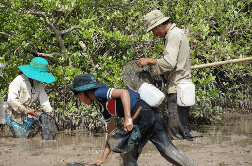
Coastal and Marine Resource Management
With a long coastline and extensive marine resources, Vietnam faces challenges in effectively managing its coastal and marine ecosystems. Remote sensing technology provides a holistic view of these areas, aiding in monitoring water quality, mapping coral reefs, tracking marine pollution, and identifying changes in coastal landforms. By analysing remote sensing data, Vietnamese authorities can develop comprehensive strategies for sustainable fisheries management, conservation of marine biodiversity, and protection of vulnerable coastal areas. This data-driven approach promotes the preservation of Vietnam’s marine resources for future generations. Vietnam’s journey into space has not only showcased the nation’s technological prowess but also highlighted its commitment to sustainable resource management. By harnessing the power of remote sensing and Earth observation, Vietnam has effectively strengthened its ability to monitor and protect its natural resources. MONRE has been using remote sensing data to monitor surface and underground waters, dams, reservoirs, and various transboundary waters. Pollution detection, management, and monitoring, such as in the case of oil spills and other wastes, have proven immensely useful in developing environmental impact assessments.
Vietnam has significantly enhanced its resource management endeavours by harnessing the power of remote sensing technology. From preserving forests and optimising agricultural practices to effectively managing coastal and marine ecosystems, remote sensing has proven to be an invaluable tool for the country. It has provided Vietnam with a comprehensive understanding of its natural resources and has facilitated evidence-based decision-making. Moreover, access to outer space, as an inalienable right of every country regardless of its development level, has helped Vietnam to leverage space data for the sustainable management of its valuable resources. This intersection of remote sensing and the universal right to space access has been reiterated by Vietnam (source) and has propelled its resource management efforts to new heights, ensuring a brighter future for its environment and economy.
Read more about the Southeast Asian space industry
This article is a part of our series on the state of space activities and space affairs in Southeast Asia. Want to know more about space activities in the region? Get in touch with our network coordinator for Southeast Asia: jerry.yao@groundstation.space
Featured image credit: Photo from the German Agency for International Cooperation (GIZ)


