Space Technologies for Sustainable Infrastructure Enhancement
- CASSINI Urban
Gabriela Quintana Sánchez
- 0
- 12 minutes read

In today’s world, the role of space technologies in fostering sustainable development and enhancing infrastructure has become increasingly vital. These technologies offer innovative solutions to address challenges related to energy access, climate change, and humanitarian relief operations. The integration of satellite data and communication systems provides valuable insights and tools to pave the way for a greener and more resilient future.
Renewable Energy and Satellite Data
One of the pressing global challenges is the need for sustainable energy sources. Climate change has underscored the importance of transitioning from fossil fuels to renewable energy. Space-based technologies play a pivotal role in this transition by enabling the identification of suitable areas for renewable energy generation, such as solar and wind power. Satellite data assists in assessing renewable resources, allowing for more efficient development and utilization of clean energy technologies.
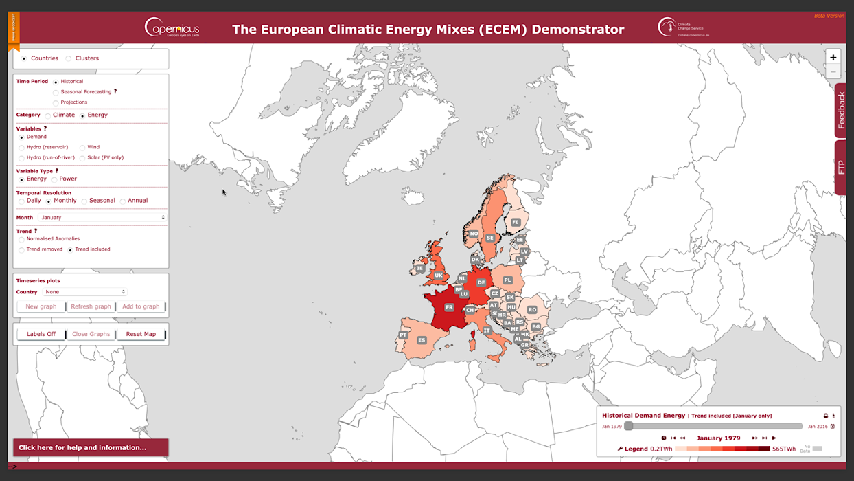
Copernicus Climate Change Service
In the EU, the energy sector increasingly depends on renewable sources- making the information associated with its production more relevant. The sector can prepare by knowing its demand through the Copernicus Climate Change Service (C3S). This service has the following goals: to provide essential information such as electricity demand and energy production from wind, solar and hydroelectric sources; to provide historical data, as well as seasonal forecasts and longer-term projections of climate indicators such as solar radiation, wind speed, mean sea level pressure, temperature and precipitation. To convert these variables into useful information; to explore high-quality climate and energy datasets, with the goals of producing maps and time series graphs of climate and energy variables, to modify the appearance of these maps and charts, download the underlying data and/or maps and diagrams, to access documentation, and including variable fact sheets, event case studies, and critical messages.
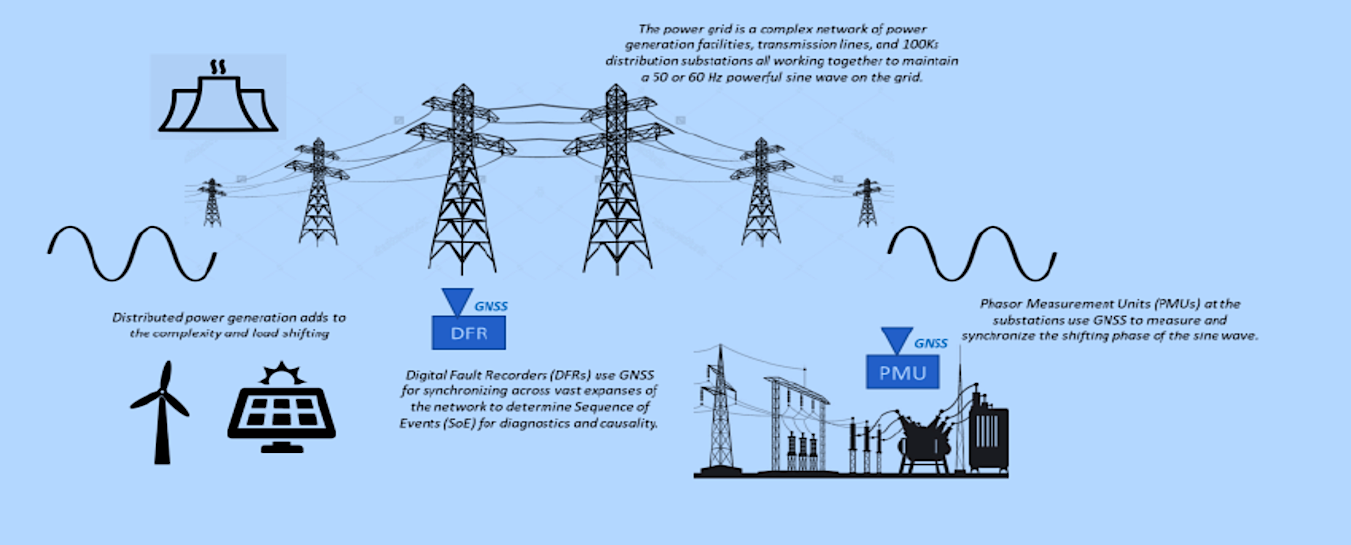
Space Positioning Navigation and Timing for Green Growth and Sustainable Development
Global Navigation System Satellite-GNSS data play a significant role in addressing several energy-related challenges, such as the protection of critical infrastructure, optimization and safety of maintenance operations, generation of smart grids and power control and distribution, and the generation of green energy. One “Smart Grid” is necessary for the next-generation power transmission network. Smart grids have fundamental requirements for time and synchronization to achieve efficient power transmission and distribution [1]
Copernicus Atmosphere Monitoring Service
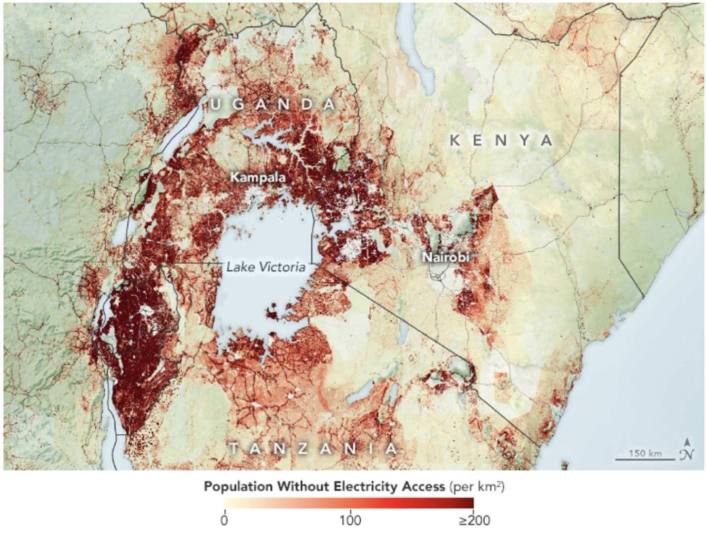
Tracking the lack of energy and access to it can be implemented with Satellite-based Night Time Light-NTL data, which can estimate electricity access and thus support electrification planning- These data are often combined with data on population density and other socioeconomic indicators. NTL data have shown that lack of electrification is most pronounced in countries where a large proportion of the population lives in dispersed, rural settlements with few resources. NTL data have also been combined with utility data to inform renewable energy and microgrid infrastructure planning. The following map is an example of estimating electricity access through satellite data.
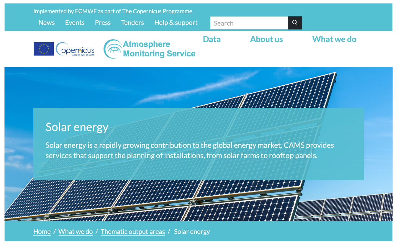
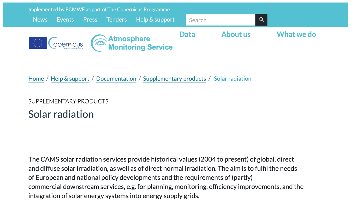
To solve the issue of the lack of electricity in remote areas, it is necessary to establish alternative renewable energy infrastructure; the calculation of accurate solar surface irradiance data (SSI) is a prerequisite for efficient planning and operation of solar energy systems. It has grown in importance over the last few decades, becoming essential for climate monitoring and analysis.
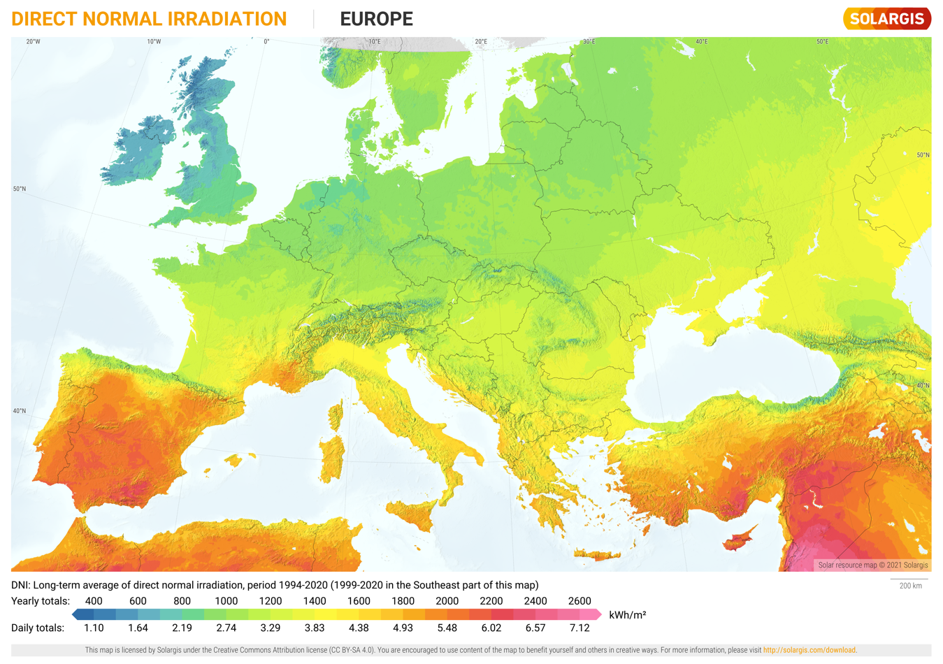
Copernicus Atmosphere Monitoring Service (CAMS) combines atmospheric modelling with Earth observation data to provide information services covering European Air Quality, Global Atmospheric Composition, Climate, and UV and Solar Energy.
CAMS services provide radiation values at the ground level, which fulfil the needs in European and national policy developments and the requirements of partly commercial downstream services, e.g., for planning, monitoring, efficiency improvements, and the integration of solar energy systems into energy supply grids.
In the Humanitarian world, the information obtained through the monitoring of refugee camps guarantees the success and efficiency of humanitarian relief operations, especially when it comes to providing supplies and maintaining basic service infrastructure. Nonetheless, many countries lack comprehensive spatial data for the production and administration of updated maps, which foster sustainable development and allow precise responses to natural disasters, humanitarian emergencies and maintenance of infrastructures. It is necessary to foment the use of satellite data in Non-Governmental Organizations (NGOs). Intending to find solutions for these specific questions, working jointly with the scientific communities and aid organizations, the CASSINI Hackathon intends to bridge these two groups.
Unleashing Innovation: CASSINI Hackathon Paving the Way for Sustainable Infrastructure Enhancement through Space Technologies
The first challenge of the 6th edition of the CASSINI Hackathon, Space for International Development and Humanitarian Aid, seeks to support the sustainable development of infrastructure. Worldwide, access to energy is a fundamental aspect of economic and social development. Continued growth in energy demand is expected in countries over the next decade, especially with a focus on improving the quality of life and essential services such as food, health, education, transportation and entertainment. Some of the most pressing energy access problems include the lack of infrastructure and distribution to remote areas.
In addition, factors associated with climate change have been driving the need for the development of increasingly efficient technologies to exploit renewable energy resources. Satellite data can help identify areas suitable for renewable energy development, such as solar and wind power.
Remote sensing technologies and methods become fundamental tools to cope with the difficulty of assessing renewable resources. Similarly, space-based communication technologies can improve the coordination of energy systems and enable more efficient and reliable transmission and distribution of electricity.
This challenge requires future innovators to develop products, devices or services that leverage European Copernicus and Galileo space data, information and signals or future services using IRIS2 to enable sustainable and impactful solutions. The next IRIS2 Satellite Constellation is the European Union’s answer to the pressing challenges of tomorrow, offering enhanced communication capacities to governmental users and businesses while ensuring high-speed internet broadband to cope with connectivity dead zones.
Stay updated
For all the latest about the CASSINI Hackathon, visit our dedicated page regularly. Also, visit the official website of the 6th Edition of the Cassini Hackathon.
Reference
[1] Fiumara, Alessandra (2020) Space Positioning Navigation and Timing for the energy sector. ESA.
[2] Edwards et al (2022) Satellite Data Applications for Sustainable Energy Transitions. Frontiers. Available at https://www.frontiersin.org/articles/10.3389/frsus.2022.910924/full
Featured image credit: Freepik


