Beyond the Evidence: Why Space Data Needs Human Awareness to Work in Court
- Education Nature FIRST
Kacia Rutkoŭskaja
- 0
- 9 minutes read

Can satellite data be used as evidence in court? The answer, as explored in our earlier article Using Satellite Data in Court: Not as Evident as It Seems, is a cautious yes. While the technology offers unique opportunities for detecting and proving environmental and wildlife crimes, its legal admissibility remains complex. During the Nature FIRST Final Conference in Rhenen, Uganda’s Chief Magistrate Gladys Kamasanyu shared her practical experience and reflections on this topic.
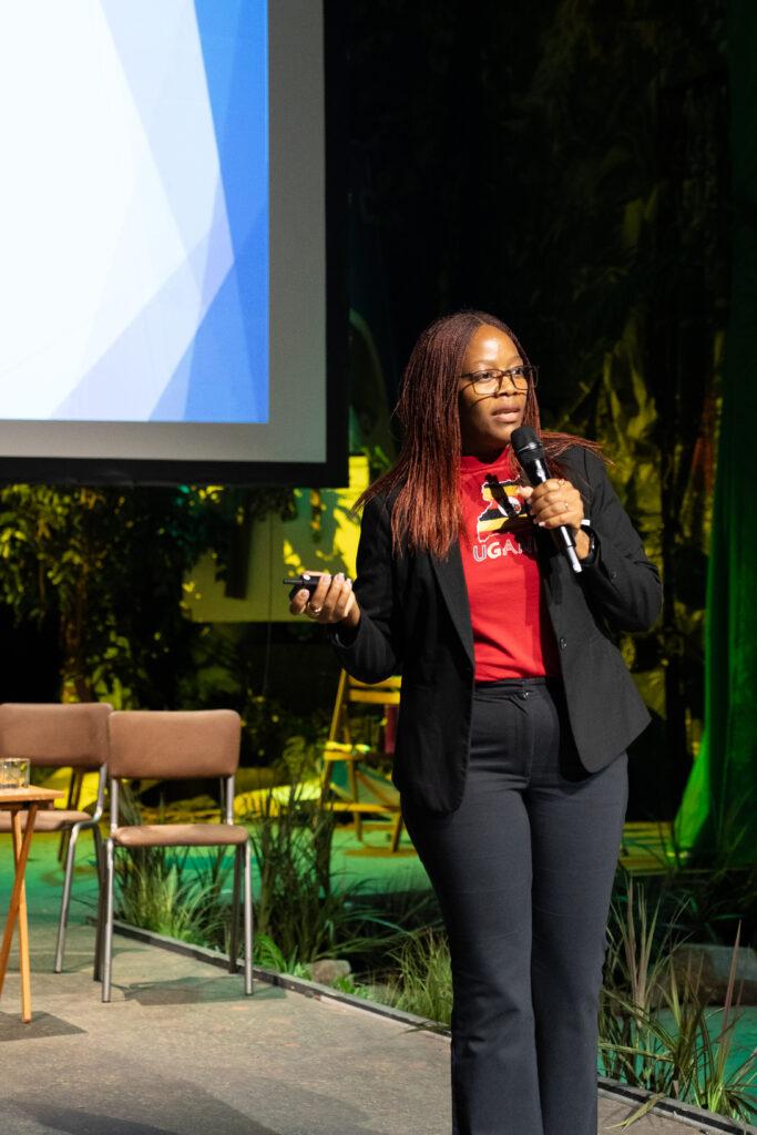
Gladys Kamasanyu leads Uganda’s specialised Wildlife Court, an African pioneering institution that focuses solely on cases involving wildlife and environmental crime. With over 2,500 cases handled, the court is breaking new ground in terms of legal structure, speed of justice, and the integration of technology. In her keynote and follow-up conversations, Kamasanyu provided first-hand insights into how satellite data is already supporting justice in Uganda, and why legal innovation must be matched by awareness and training.
(Photo by Nalini Heinmüller)
Coordinates as Proof
In multiple cases, space-derived coordinates have been used to prove that a crime took place within protected areas. “Our national parks don’t have physical fences,” Kamasanyu explained. “So to prove that someone hunted or killed an animal inside a national park, we use coordinates from GPS-enabled devices to locate the crime scene. That data is matched against official maps.”
This process is already helping to establish jurisdiction and demonstrate violations of protected area laws. While satellite imagery itself may not yet be used as direct visual evidence, spatial data is increasingly relevant in legal investigations and prosecution.
From Potential to Practice: The Chain of Evidence
Yet having the data is not enough. Kamasanyu underscored the importance of proper procedures in collecting, handling, and presenting electronic evidence. “You cannot just walk into court with a phone and show a photo,” she said. “You need to extract that data properly, store it securely, and be able to trace every hand it passed through.”
This legal concept — the chain of custody — is essential for admissibility. If the evidence is mishandled or the source cannot be verified, it can be dismissed. And the same standards apply whether the source is a ranger’s GPS unit or a satellite in orbit.
The Gap: Capacity and Comfort
For satellite data to be effectively used in court, people must be trained to use it. “The tools are there, but many people avoid using them because they don’t know how,” Kamasanyu said. She emphasised the need for capacity building across the legal system, from law enforcement officers to prosecutors and judges.
Technology alone will not bridge the gap. Legal actors must be able to access, interpret, and defend data in court. Emerging technologies like AI introduce additional legal complexity. “If AI analyses your data, who do you cross-examine?” she asked. Until legal systems have clear frameworks for responsibility and transparency, advanced tools will remain underused or misunderstood.
The Role of Awareness and Prevention
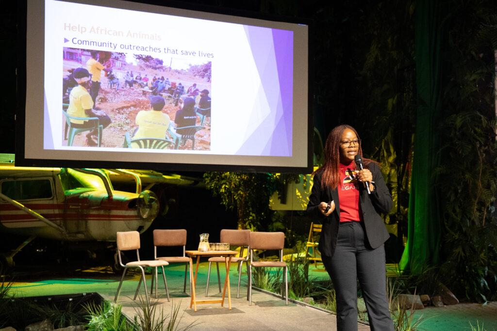
Kamasanyu’s message went further than courtroom procedure. Her non-profit, Help African Animals, works to increase awareness about wildlife laws and shift the mindset of communities living near protected areas. She believes that people often commit environmental crimes not out of malice, but out of necessity or lack of knowledge.
“Many people don’t even know what’s illegal—or why it matters,” she said. “When we speak out for wildlife, we’re speaking out for ourselves too.”
Her team engages directly with communities, law enforcement officers, and soldiers to help them understand the legal and ecological consequences of actions like poaching, illegal fishing, or habitat destruction. This work helps reduce future cases before they reach the courtroom.
“Technology can support justice,” she said, “but justice begins with knowledge.”
Visit Help African Animals website
Towards Better Integration: Enter SatInsight
At Groundstation.space, Kamasanyu’s insights reinforce why technical innovation must go hand-in-hand with education, usability, and local relevance. This is exactly the aim of SatInsight Tech Hub, part of our mission to democratise Earth observation data and promote its use in solving real-world challenges.
SatInsight is co-invested by the Province of South Holland and implemented with partners including NL Space Campus, the Netherlands Space Office, and Innovation Quarter. It is designed to bridge the gap between cutting-edge remote sensing and AI technologies and their application in non-space sectors — from environmental law to biodiversity monitoring.
Through the current development of the Groundstation 2.0 platform, SatInsight will enable transparent, interoperable, and transaction-ready data products using smart contracts and traceable licensing. These tools make it easier for satellite data to be not only viewed from space, but trusted in courtrooms and communities alike.
Biodiversity and nature conservation are central themes of SatInsight. Inspired by European projects such as Nature FIRST, the initiative seeks to strengthen cross-sector collaboration, where environmental protection, legal systems, and digital tools align.
To truly bring space data into court, we need more than evidence. We need people who know how to use it.