Monitoring Volcanoes from Space: Buying Time
- Disaster Management Technology
Gabriela Quintana Sánchez
- 0
- 14 minutes read
The evolution of SAR satellite imagery for measuring minute surface deformation in areas around volcanoes is the latest space application in the volcanic researchers’ toolkit to spot early-warning signs of possible eruptions and dangers to the local population.
Earlier this week, two active volcanoes, in two distinct parts of the world, made the news by emitting large amounts of ash, rising high into the atmosphere. Both ‘Nevado del Ruiz’ in Colombia and Mount Merapi in Indonesia have long been active. The Colombian volcano has been on ‘yellow’ alert since 2012, while Merapi has erupted regularly since 1548.

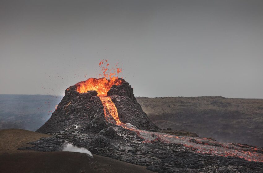
Formation of volcanoes
Volcanoes are formed by folds, faults, uplifts, and erosion of the Earth’s crust. They are formed by the slow accumulation of lava in these ‘weak spots’ of the crust, allowing high pressure magma to rise near or above the surface. This magma is made of molten rock, crystals, and dissolved gases. Only after the magma erupts from a volcano it is called lava.

Currently there are about 1,350 potentially active volcanoes worldwide, not counting the volcanoes under the oceans. About 500 of these have erupted in the past 100 years. Many of these are located around the Pacific Ocean in what is known as the Ring of Fire.
The following figure shows the eruptive process of a volcano, bottom to top:

Monitoring Nevado del Ruiz
On 20 March 2023 local news channel ‘Opinion Caribe’ in Colombia reported: “In recent days, residents of the areas surrounding the Nevado del Ruiz volcano have reported on social media about new activity, related to the expulsion of ash.
The volcano’s behaviour was reported to have shown changes on Monday morning, when a large smoke column of ash and gases was filmed and photographed.
The Colombian Geological Service said that it has been permanently monitoring the volcanic activity and that these are “seismic signals related to the movement of fluids inside the volcanic conduits”, which could be confirmed thanks to the cameras installed in the area, as well as the information provided by the staff of the Los Nevados National Natural Park.
“The ash emission recorded today at 09:02 is the one that has stood out the most for being one of the highest in the last few days, and also due to the excellent atmospheric conditions, which allowed it to be visible from several municipalities in Caldas, Tolima and Risaralda. The height of the column, with dispersion towards the southwest, was 2700 m,” the institute explained.
However, it clarified that “this type of phenomenon is considered within the yellow activity level in which the Nevado del Ruiz volcano has been since 2012 and it is not ruled out that the volcano will continue to emit gases and ash”.
Villages around Merapi blanketed in ash
Only a week earlier, long-active Merapi in Indonesia surprised authorities and local residents alike, when it erupted suddenly. Al Jazeera News reported on 11 March 2023: “Indonesia’s Mount Merapi has erupted, spewing out smoke and ash that blanketed villages near the crater and forcing authorities to halt tourism and mining activities on the slopes of the country’s most active volcano.
The volcano, located in Indonesia’s Yogyakarta special region, erupted at about 12pm (05:00 GMT) on Saturday and unleashed clouds of hot ash and a mixture of rock, lava and gas that travelled up to seven kilometres (4.3 miles) down its slopes. [] There were no immediate reports of casualties.”
The latest addition to the volcano’s Wikipedia page reports: “An eruption started on 11 March 2023 at around 12 p.m. local time. A lava flow up to 7 kilometers long and a column of hot cloud rising up to 100 meters high were observed. Local authorities advised residents living in Merapi’s slope to stay at least 7 kilometers away from the crater.”
Using SAR to monitor signs of volcanic activity
Many volcanoes are an imminent hazard to the people living in its surroundings. For that reason, research institutes are working round the clock to monitor the evolution of active volcanoes. One of the latest tools developed to monitor volcanoes is InSAR.
The rapid evolution of radar remote sensing technology over the last years have made this an important tool in the volcanologists toolkit. The quality of interferograms and deformation maps based on radar satellite data has increased such that it now shows the important details allowing us to follow the process leading up to and following an eruption. Satellites can now measure the smallest ground deformations caused by pressure changes in magma chambers, following the building up or outflows of magma, intrusion of sills and dikes, changes in local hydrothermal systems, and finally, to map the extent and thickness of lava flows during eruptions.
As an example of this, we can see the deformation map derived from the processing of two SAR Sentinel-1 SAR images, taken on 3 and 27 of November 2014, of the Santa Catarina Do Fogo Volcano in Cape Verde, in the Atlantic Ocean. Its last eruption started shortly after 10am on Sunday 23 November 2014, after only a few days of heightened seismic activity.
The population of Chã das Caldeiras, totalling around 1,000 inhabitants, spent the night outside their homes due to strong earthquakes. When the eruption started, local authorities then evacuated the village.
The eruption stopped on 8 February 2015, after 77 days. 75% of the buildings in the villages of Portela, Bangaeira, Ilhéu de Losna, and Chã das Caldeiras had been destroyed. Most of the buildings of the towns were buried under a thick layer of lava.
Many volcanic eruptions are preceded by periods of inflation, resulting from magma chamber pressurisation caused by sudden magma build-up. In the final stages and after an eruption, the magma chamber deflates, and the ground subsides. Monitoring inflation and deflation provides important clues about the structure and the state of active volcanoes.
The following deformation map (left) shows us the north flank zone of the Santa Catarina Do Fogo Volcano, with surface deflation in red after the last eruption. This deflation was verified in the images taken from Google Earth around that same point in time (right).

Measuring lava thickness from space
Another factor we can measure with SAR images is lava thickness. In below example, the lava thickness after the eruption of the Okmok Volcano in Alaska in 1997 can be derived from the height difference between pre- and post-eruption DEM (Digital Elevation Model) data. The pre-eruption DEM is produced using interferograms from the ERS-1 satellite in the 1990s. This is then compared with the post-eruption DEM, which was produced using Sentinel-1 TOPSAR data processing. The red line in the image below is the lava perimeter from a field survey, encompassing a lava field of around 9.8 km², while the coloured areas are thickness measurements by Sentinel-1.

Interferometry
We can also generate interferograms using SAR images, as we can see in the following example of the Colima Volcano in Mexico. This interferogram is based on Sentinel-1 images after an eruption on 18 January 2017. It was created using the ESA Grid Processing on Demand (G-POD) application for Earth Observation. This platform is now part of the GEOHazards TEP application.

Buying time
The use of EO permits us to remotely study terrestrial events caused by the geodynamics of the Earth. By monitoring these events we can spot early signs of increased volcanic activity, like typical background surface deformation, seismic precursors, and magma ascent. This early warning data gives us valuable time to alert the population longer before any imminent events.


