Using SAR satellite remote sensing for earthquake disaster management
- Disaster Management Technology
Gabriela Quintana Sánchez
- 0
- 9 minutes read
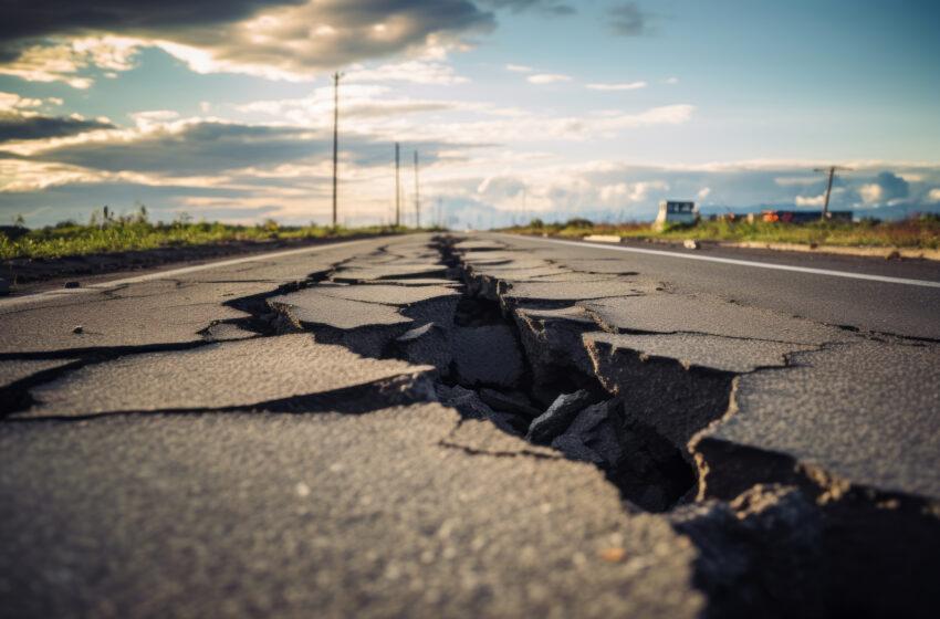
Earthquakes are one of several natural disasters that can occur unexpectedly and with great damaging effects to humans and property. SAR satellite data can help map earthquake disaster areas rapidly and with great accuracy, under all weather conditions. Understanding seismic activity and crustal deformations can help find fault lines and manage earthquake risks before and after they happen.
Tectonic activity
Much of the Earth’s landscapes are formed by tectonic activity, when the different continental shelves move into and out of each other, forming mountain ranges, valleys, and rifts. Tectonics provide a framework for understanding earthquake and volcanic belts that directly affect much of the global population.
Tectonic activity is the cause of the Earth’s major mountain belts, containing thousands of kilometres of folded, folded, overturned and sometimes highly fractured strata. Strata are often folded, overturned and sometimes highly fractured. Some of these layers bring ancient fossil-bearing rocks to the surface, revealing a history of deformation that shows that some of these layers have emerged from much deeper levels of the crust.
What happens during an earthquake?
During large earthquakes, the crust moves a few meters along faults. During inter-seismic periods, these fault displacement lengths and velocities can be obtained.
Human activities like mining and construction can also generate crustal deformations, although more often tectonic activities cause risks to human activities. Understanding tectonic structures is essential for the well-being of society.
Tectonics researchers identify and describe the main structures of the Earth’s surface. Most of the tectonic layers on Earth are covered by vegetation or sediments. Consequently, analysis of active regions must be done using data collected from a limited number of resources. Several mapping techniques make it possible to reconstruct the underlying orientation and shape of existing structures. In recent years, advances in aerial photography, satellite imaging and the development of the Global Positioning System (GPS) have helped progress tectonics science.
In satellite remote sensing, especially the evolution of SAR interferometry technology has made it one of the most promising methods of detecting displacements of the Earth’s surface.
Kumamoto Earthquake, Japan 2016
In April 2016, a series of seismic events took place in the Kumamoto Prefecture in Japan. The first earthquake was felt one on 14 April, with magnitude 6.2, followed by another earthquake of magnitude 6.0 on the same day, both happening on the Hinagu fault. On 15 April a magnitude 7.0 earthquake occurred, the strongest earthquakes recorded in Kyushu during the modern era. The calculated surface displacement to the north of the fault line was estimated to be 12 cm horizontally and 20 cm vertically. South of the Hinagu Fault horizontal displacements of 5 cm were calculated.
SAR satellite interferograms of the Kumamoto Earthquake
Using before and after SAR satellite images of the area, a surface displacement interferogram can be created. Using Sentinel-1 ascending mode tracks created on 8 and 20 April consecutively, the first interferograms were generated. These graphs show the displacement caused by the combined preliminary and main earthquakes. The images coincide with the rupture area defined by the U.S. Geological Survey (USGS).
The seismic interferogram can be created through a DInSAR analysis in the Sentinel-1 Toolbox (see further down in this article). The analysis basically calculates the phase shift of the retuned Sentinel-1 C-band radar signals between the two dates.
The Sentinel-1 satellite uses a 5.4 cm wavelength C-band radar signal. The phase of this wave is represented by an angle ranging from 0 to 360 degrees, and after one cycle it returns to 0 degrees.
A colour within a ring pattern in an interferogram shows the phase difference caused by the difference in distance between the two moments of time, caused by the difference in distance between two observations of that point.

In the initial examples ascending orbit data was used (satellite track from south to north). A similar analysis can be done using descending orbit data (obtained when the satellite flies north to south).
The Sentinel-1 descending-orbit seismic interferogram was generated based on data obtained on 27 March and 20 April 2016. The graphs show deformation fringes that show the epicentre of the Kumamoto earthquake, with better demarcation in the west-east direction.

Obtaining physical parameters of the surface through satellite remote sensing allows us to optimise time, costs and field work, giving us a quick insight to an event in an area of interest. Combined with cadastral data of the affected area we can quickly estimate the areas with greater damage to population and infrastructure.
This type of satellite observation of earthquake disaster areas can be of great value in different stages of disaster monitoring and recovery. It allows quick disaster area mapping, regardless of weather (SAR penetrates clouds and is not depending on daylight). It prevents the requirement of eople entering potentially hazardous areas to make measurements, althoughm in-situ surveying activities to assess damage will always still be necessary.
Learn how to use SAR data yourself
The Alaska University website offers many good and free tutorials on SAR interferometry:
How to Create an Interferogram Using ESA’s Sentinel-1 Toolbox | ASF (alaska.edu)

Also read
Interpreting SAR satellite images
Featured image credit: Freepik

