From Satellites to Streams: Turning Global Earth Observation Into Local Water Intelligence
- Industry Water&Food
Andrei Bocin-Dumitriu
- 0
- 12 minutes read
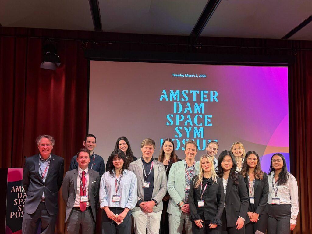
Amsterdam Space Symposium 2026 | Space for Climate Track | 3 March 2026
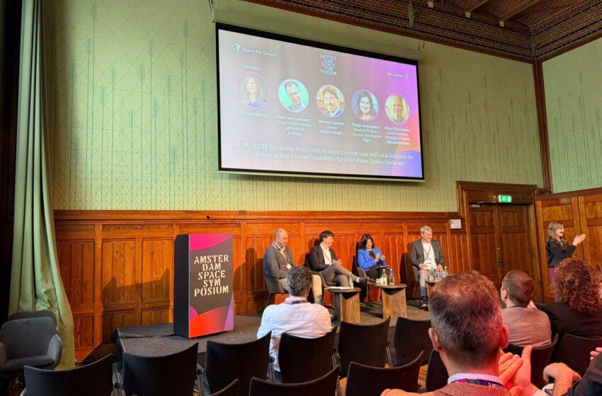
The session that followed “When Space Meets Place” in the Veilingzaal tackled a challenge that shares the same DNA: satellite data is technically ready, but the systems that need to use it aren’t. In the water domain, though, the timelines are even more humbling.
Speakers from Rijkswaterstaat, STOWA, Water Insight, and Fugro — Rinus Schroevers, Hans van Leeuwen, Marnix Laanen, and Pooja Mahapatra — spent the session toggling between two modes: honest about what’s taken decades, and optimistic about what’s finally starting to move.
The 25-year number
Rinus Schroevers from Rijkswaterstaat opened with two case studies that together tell the whole story of EO adoption in water management.
The first was a win. Since 1994, Rijkswaterstaat has run a fully automated satellite-based oil spill detection pipeline for the North Sea. Within 20 minutes of a satellite overpass, an alert lands in the inbox combining the detected spill location, nearby vessel traffic, and instructions for aerial follow-up. A plane is often already in the air. The result: North Sea oil spills dropped from thousands per year to around ten to twelve. The ships know they’re being watched.
What made it work, Schroevers explained, wasn’t the satellite. It was the operational system built around it — the pipeline, the alert logic, the response protocol. The data became infrastructure because it triggered action.
The second example was more sobering. Satellite-derived chlorophyll data for ecological reporting of the North Sea’s coastal zone was first demonstrated around 2000. It only became fully operational — actually replacing some in-situ measurements in official reporting — in December 2024. Twenty-five years from first product to embedded practice.
Schroevers put the challenge plainly: “This is our main challenge. It’s getting into operation. It’s not about technical development.” The technique was mature long before the institutions were ready for it.
Why oil spills succeeded where chlorophyll didn’t
The contrast kept surfacing through the session, and it’s worth unpacking. The oil spill system worked fast because the satellite output was immediately legible to the people who needed to act on it. No complex processing chain, no regulatory translation required. Someone received an email, looked at a map, and dispatched a plane. The workflow barely changed — it just got faster and more reliable.
Chlorophyll monitoring required the opposite journey. The output had to be validated against decades of in-situ sampling methods. Regulatory frameworks for reporting under the EU Water Framework Directive specified measurement approaches that didn’t include satellite data. Countries like Finland moved ahead; the Netherlands didn’t — until recently, when EO-derived data was accepted as a supplementary input to the official reporting cycle. A small step, but the first.
The lesson, as one panellist put it: regulations aren’t laws of nature, they’re agreements — and agreements can change, but it takes evidence, patience, and occasionally a cross-border embarrassment. Marnix Laanen from Water Insight noted the moment that catalysed North Sea cooperation: a water sample taken on the UK side of an invisible line would flag a red alert, while one taken 100 metres away on the Dutch side would show green. That inconsistency created the political impetus to develop a consistent, satellite-based monitoring approach together.
Satellites as diagnostics, not replacements
A useful analogy ran through the session. Marnix Laanen described the model as comparable to preventive healthcare: you don’t go to the hospital every two weeks for a blood sample. You see your GP when something seems wrong, and get precise diagnostics only when there’s a signal. Satellite monitoring provides the broad, continuous screening layer. Field measurements — still necessary, still valuable — are then targeted only where anomalies appear.
Pooja Mahapatra from Fugro (which last year acquired water quality EO specialist EOMAP) made the economics concrete. A full in-situ monitoring programme for a country like Germany runs to tens of millions of euros annually. A satellite observation sweep of the same territory costs a fraction of that, delivers better spatial coverage, and allows field teams to focus their sample collection precisely where the satellite is flagging an issue. The total cost of a hybrid system can come in significantly below the traditional approach — with better coverage.
That business case exists. The challenge is getting it in front of the right budget holders — which, as Hans van Leeuwen from STOWA observed, is rarely the person who understands the technical argument.
The system problem: water quality doesn’t exist in isolation
Hans van Leeuwen introduced a framing that extended the scope of the discussion considerably. Water quality, he argued, cannot be monitored or managed in isolation. What happens in a river or lake is a downstream consequence of what’s happening in the soil, the vegetation, the atmosphere, the hydrology upstream. During extreme dry periods, chemical concentrations in water bodies spike. During floods, entirely different dynamics emerge.
What water managers actually need, van Leeuwen argued, is a daily monitor of the full soil–water–vegetation–atmosphere system — not just a chlorophyll reading, but the context that explains it. That’s a much larger ambition than a single sensor product, and it points toward the kind of integrated, continental-scale data infrastructure that only satellite observation can provide.
STOWA’s “Space for Water” pre-commercial procurement initiative is trying to build exactly this, with 25 European consortia responding to the initial call. The goal is to produce actionable water information services validated across multiple European regions — and to create procurement pathways that outlast the project cycle.
The plumbing nobody wants to fund
A recurring frustration in the session was the gap between EO capability and EO usability. Laanen and Mahapatra were direct about what it actually takes to get a satellite water quality product into the hands of an operational water manager: cloud infrastructure, user-friendly applications, validation campaigns against field data, and ongoing support for the workflows it needs to fit into.
None of that is glamorous. None of it attracts research funding. But without it, technically excellent data products sit unused — because a water authority doesn’t want to run analytics experiments, they want a validated service that integrates with the systems they already use.
Mahapatra drew on Fugro’s experience in Germany: surveying water authorities revealed that they had no interest in developing the analytics themselves. They wanted something they could take off the shelf, trust, and plug in. The investment required to get there — the “ecosystem around EO,” as she called it — is just as important as the satellite data itself.
Does it take a disaster?
One of the sharper exchanges in the session came around a simple question: do we need a crisis to accelerate adoption?
The evidence is suggestive. The Prestige oil spill off Spain in 2002 was what pushed Rijkswaterstaat toward full operational deployment of the oil spill pipeline. COVID, noted Laanen, was a spike in acceptance of autonomous water monitoring instruments — because field teams couldn’t get to the lakes, so automated remote sensing suddenly looked very attractive.
The panel’s consensus was uncomfortable but honest: crises help, but we shouldn’t wait for them, because by then we’re reacting rather than anticipating. The better argument is that the disaster is already unfolding — climate change is making water systems more extreme, more unpredictable, and more consequential — and the monitoring infrastructure to manage it needs to be in place before the next event, not after.
As one speaker put it: “We can see the train wreck coming. That’s exactly why we need to get this in place.”
What’s actually changing
The session wasn’t defeatist. A few concrete shifts were noted. The Netherlands has now accepted EO data as a supplementary input to Water Framework Directive reporting — a small but real regulatory step. Agriculture is an example from an adjacent domain where satellite-based monitoring of farming practices has become fully operational across Europe, embedded into subsidy control systems. It took time, but it happened.
The pattern, several speakers agreed, is that adoption eventually follows trust — and trust comes from repeated demonstration, validation, and the accumulation of ambassadors inside organisations who have used the data and found it reliable. The session closed with a call that echoed the one from the morning: share the success stories. Build the evidence base. Don’t let good pilots disappear quietly into project archives.
What the room took away
The water domain has a 25-year reference point for how long the journey from demonstration to operation can take. The session’s implicit argument was that the next generation of services doesn’t have to repeat that timeline — if the sector invests not just in better satellites and better algorithms, but in the operational, regulatory, and organisational infrastructure that turns data into decisions.
The satellites are already in orbit. The harder work, as one speaker put it at the close, is on the ground.